Aerial Photography
Aerial landscape photography has long fascinated me. Luckily advances in Drone/UAV technology have now put aerial photography well within the reach of many photographers - but why a drone? The alternative of course is an aeroplane or helicopter and whilst both have advantages, conventional aviation isn’t cheap (especially helicopters) or immediate. They require a second person to fly whilst you take the photographs and certainly in the case of an aeroplane can’t be precision hovered whilst the photographer carefully attempts to compose a photograph. That said one or two of the aerial photographs have been taken from helicopters usually Robinson R22's. A drone by comparison can be put into the air very quickly. It can be flown lower than an aeroplane and at a reasonable cost. If the light takes a turn for the worse it can be brought down to save battery life but be back in the air very quickly if things improve. For the serious photographer, they are potentially one of the most exciting technological developments since the emergence of digital.
(The legal bit! - with the revised EASA UAV regulations that came into force on the 31 December 2020 I now operate UAVs commercially in the 'Open, A3 Category' (ex PfCO CAA ID UAS 6899).
Click on each thumbnail to view the photographs.
All prices include UK postage.
You can purchase photographs online using the secure payment link that will appear when you click on the thumbnails.

Great Gable

Hidscarth & Dale Head

Scafells & Wasdale

Buttermere from Red Pike

Buttermere & Newlands Fells

Kirk Fell & Great Gable

Buttermere Fells

Buttermere

Autumn Colour Keswick
Above Loweswater

Spring Cat Bells
Winter Derwent Water

Cat Bells and Newlands

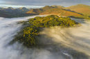
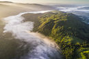
Early Morning Mist
Langdale from Loughrigg
Light & Shadows Brathay
Dawn Glenridding
Glenridding from Place Fell
Ullock Pike
April Morning Blencathra
Bamburgh
Dunstanburgh Castle
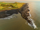
Dunstanburgh
Skiddaw & Blencathra
Staithes
Blencathra January
Yewbarrow & The Scafell's
St Herbert's Island Derwent Water
Wasdale Valley

April Dawn Derwent Water
Dawn Derwent Water
Derwent Water
Causey Pike
Heavy Frost Blencathra
Dawn Cat Bells
Sunrise Cat Bells
Sunrise Langdale Pikes
Stickle Tarn Langdale
Newlands Valley
Sunrise Helvellyn
Blencathra
Bassenthwaite
October Inversion Derwent Water

Nichol End Derwent Water
Swinside

Dawn Mellbreak

Cat Bells

Little Langdale

Little Langdale Tarn

Buttermere

Buttermere

Causey Pike

Thirlmere

Cat Bells

Stonethwaite Borrowdale

Cat Bells

Hallin Fell

Crummock Water

Loweswater

Sharp Edge

Rydal Water

Elter Water

Tarn Hows
Loughrigg & Rydal Valley

Grasmere

Derwent Water

